See the Spectrum.
Build the Picture.
Arc-RF turns spectrum observations into model-readable evidence. It classifies supported RF signatures, maps detections back to physical frequency coordinates, and can pair calibrated direction finding with TAK publication in a program-configured system.
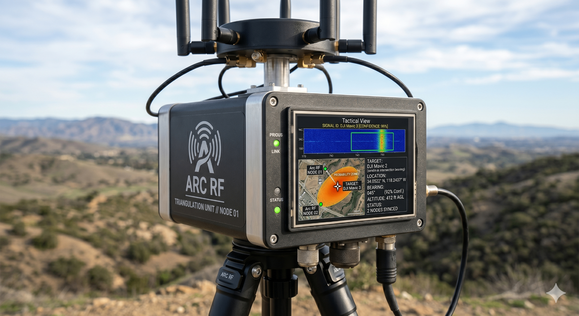
The Spectrum Is Crowded & Hostile.
Relevant emissions compete with Wi-Fi, Bluetooth, telemetry, interference, and multipath. A useful RF picture must preserve what was observed, distinguish signatures the model has been trained to recognize, add bearing evidence where the hardware supports it, and show uncertainty instead of reducing every signal to an alarm.
See the signal.
Build the evidence.
Arc-RF converts spectrum observations into visual representations that edge models can detect and classify. Compatible calibrated hardware can add direction-finding evidence; configured nodes can combine bearings into an estimate and explicit uncertainty for the operator picture.
- 01
Capture
Recorded or configured spectrum observations
- 02
Render
Time-frequency representation
- 03
Detect
Edge model finds signal signatures
- 04
Bear
Calibrated direction finding adds geometry
- 05
Publish
Estimate, uncertainty, and confidence to TAK
Configuration note / Classification, speed, bearing, and geolocation performance vary with the receiver, model, RF environment, antenna geometry, and deployment.
RF Evidence. At the Tactical Edge.
Spectrum as Vision
Arc-RF converts recorded I/Q observations into spectrograms, detects learned signal signatures, and maps each detection back to center frequency, bandwidth, and duration. Classification depends on the trained model and the RF conditions it has been validated against.
Phase Interferometry DF
When paired with a coherent multi-channel receiver and calibrated antenna array, Arc-RF can add angle-of-arrival evidence to a classified signal. Bearing performance depends on calibration, array geometry, SNR, multipath, and installation.
Cooperative Geolocation
Program-configured nodes can exchange bearing evidence and combine intersecting lines of bearing into a location estimate and uncertainty region. Accuracy depends on node geometry, synchronization, transport, and the local RF environment.
Organic UAS Baseline
A compatible UAS can carry an additional receiver to improve geometry where fixed nodes are impractical. Flight authority, route selection, communications, and safety behavior remain part of the integrated program configuration.
Field Power & PACE
Available node configurations can pair battery and solar-support options with program-selected communications bearers. Endurance, duty cycle, mesh, cellular, and satellite availability vary by hardware and network plan.
TAK / CoT Integration
Arc-RF can publish standardized Cursor on Target events into ATAK or WinTAK when integrated with the mission network. Each event carries only the identity, bearing, location, and confidence fields available from the configured sensors.
Scales from a Scout to a FOB.
Standalone Ground Station
A single field node monitors a configured band, classifies supported signatures, and can publish a line of bearing into TAK. Coverage and confidence vary with antenna placement, receiver, model, and spectrum conditions.
Cooperative Node Set
Multiple calibrated nodes combine bearing evidence into a location estimate with an explicit uncertainty region. The program selects the transport path; geometry, synchronization, terrain, and multipath determine resulting accuracy.
Node + Organic UAS
A compatible UAS can extend the measurement baseline for mobile or infrastructure-limited missions. Result timing and accuracy depend on airspace, route authority, receiver integration, link availability, and observation geometry.
From I/Q to RF Evidence.
Arc-RF applies a repeatable evidence pipeline: convert I/Q observations into time-frequency views, detect supported signatures, preserve physical coordinates, and add direction-finding geometry when the selected receiver and antenna configuration provide it.
Turn Invisible Activity Into Mission Evidence.
Arc-RF combines spectrum classification, configuration-dependent direction finding, cooperative geolocation, and TAK integration in a field-oriented architecture. Get in touch to review the receiver, antenna, model, network, and power configuration for your program.

Sovereign by design.
Open by choice.
Arc builds on open-source foundations, including LlamaFarm and Atmosphere. Programs can deploy core workflows inside customer-controlled infrastructure, define data boundaries, and negotiate model, sensor-data, and mission-log rights in the acquisition terms. Open interfaces preserve an exit path without promising that every mission dependency is open source.
Put Arc
on the mission.
Defense inquiries
[email protected]Partnerships & commercial
[email protected]Powered by Rownd