01
ISR & Area Search
Execute validated routes and search patterns, correlate onboard detections with mission geography, and return concise observations instead of requiring constant raw-feed monitoring.
Arc connects operators, sensors, autonomous vehicles, deployable model operations, and resilient mission networks in one collaborative system. Perception, planning, swarm coordination, and decisions stay close to the mission—with full communications PACE across program-selected radios, mesh, LTE/5G, and SATCOM.
Air, spectrum, sensors, vehicles, and the operator layer share one sovereign runtime. Each system has a distinct job; together they coordinate through program-selected PACE communications and continue when a bearer is degraded or unavailable.
Mission-ready carrier + PACE
One flight-optimized carrier board with compute, acceleration, modular radios, and the Arc mission stack provisioned for the target vehicle. Change the link plan without rebuilding the autonomy layer.
Autonomous aerial intelligence
On-aircraft perception, planning, and mission execution for 10-inch quadrotors through 5-foot fixed-wing platforms. The aircraft closes the loop from validated intent through recovery.
Mission-native operator control
A field-first replacement for fragmented ground-control workflows. Plan, fly, monitor video and detections, and intervene from one responsive web, Android, phone, tablet, or desktop surface.
Signal intelligence and triangulation
Man-portable RF intelligence that treats spectrum observations as a vision problem, classifies labeled signatures at the edge, combines bearing evidence, and publishes mission-ready events.
Agentic edge sensor fusion
A provenance-aware evidence layer that correlates program-selected vision, RF, LiDAR, acoustic, telemetry, and TAK observations without hiding uncertainty or contradictory sources.
Autonomy for any vehicle
A vehicle-independent autonomy layer for air, ground, surface, subsurface, and mission-specific platforms. Run connected, through a degraded link, or in configured low-signature profiles.
Persistent autonomous sensor mesh
A distributed small-UAS-class sensing system designed to perch, watch, classify local events, reposition, recharge, and share concise conclusions when the selected platform and program support each behavior.
In-theater model operations
A deployable model-operations node that turns reviewed mission evidence into target-aware candidates, comparison results, and approved edge artifacts without requiring a continuous cloud pipeline.
Arc normalizes sensor evidence into a shared local world model. Mission-tuned models interpret the scene, propose or execute policy-bounded actions, and synchronize tasking and conclusions across the available mission network—without depending on a cloud round trip.
Vision models, mission SLMs, fusion, and tool-calling agents run inside the platform perimeter.
Each deployment is bounded by the approved aircraft, payload, communications loadout, autonomy behaviors, and mission authority.
Execute validated routes and search patterns, correlate onboard detections with mission geography, and return concise observations instead of requiring constant raw-feed monitoring.
Run bounded patrol, overwatch, and alerting missions with explicit geofences, recovery criteria, and operator intervention paths.
Task compact quadrotors or longer-endurance fixed-wing aircraft to search named areas, identify mission-relevant observations, and report locations over the available PACE path.
When paired with the appropriate Arc-RF payload, collect and correlate spectrum observations while the aircraft executes the approved flight plan.
Use program-qualified swarm behaviors to share mission context, distribute bounded tasks, and preserve local aircraft safety authority across the team.
Inspect linear and distributed assets with onboard processing, configurable endurance, and store-and-forward reporting when connectivity is constrained.
Arc-UAS executes the approved search geometry, evaluates observations onboard, and forwards mission-relevant conclusions instead of demanding a continuous raw-feed watch.
Configured nodes patrol a defined perimeter, distinguish a boundary observation, and cue the operator while hold, return, and intervention paths remain explicit.
Arc-RF can combine classified spectrum observations and calibrated bearing inputs from multiple nodes into a location estimate that retains source, confidence, and uncertainty.
Program-qualified collaborative behaviors partition work, share observations, and reassign bounded tasks while each vehicle keeps local safety and recovery authority.
Representative mission logic — aircraft, sensors, models, communications, authority, and performance are configured and validated for each program.
Plan routes, direct vehicles, inspect RF tracks, fuse detections, and intervene from one coherent operating picture. Arc-UI is the mission-native alternative to fragmented QGroundControl and Mission Planner workflows.
Explore Arc-UI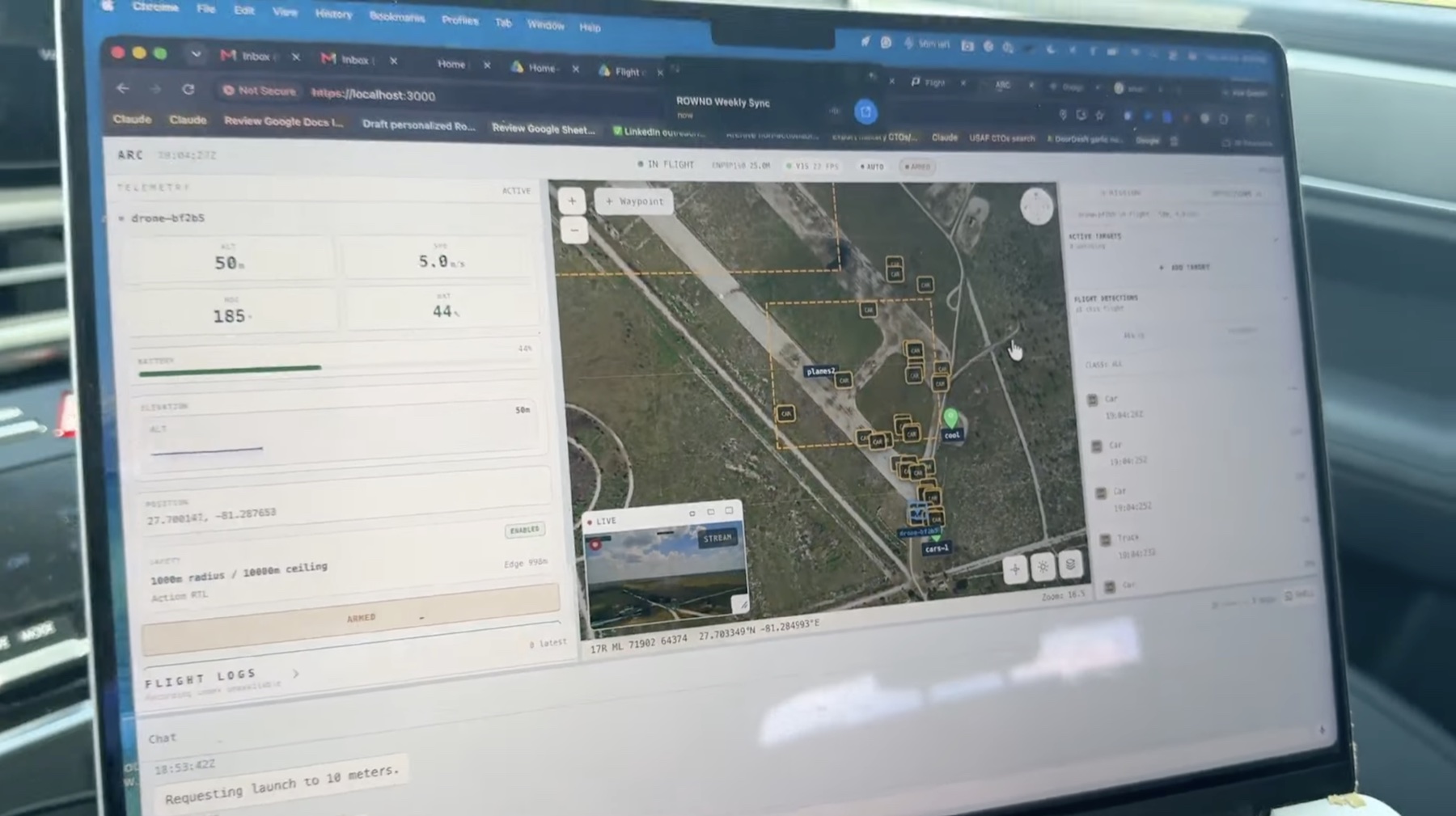
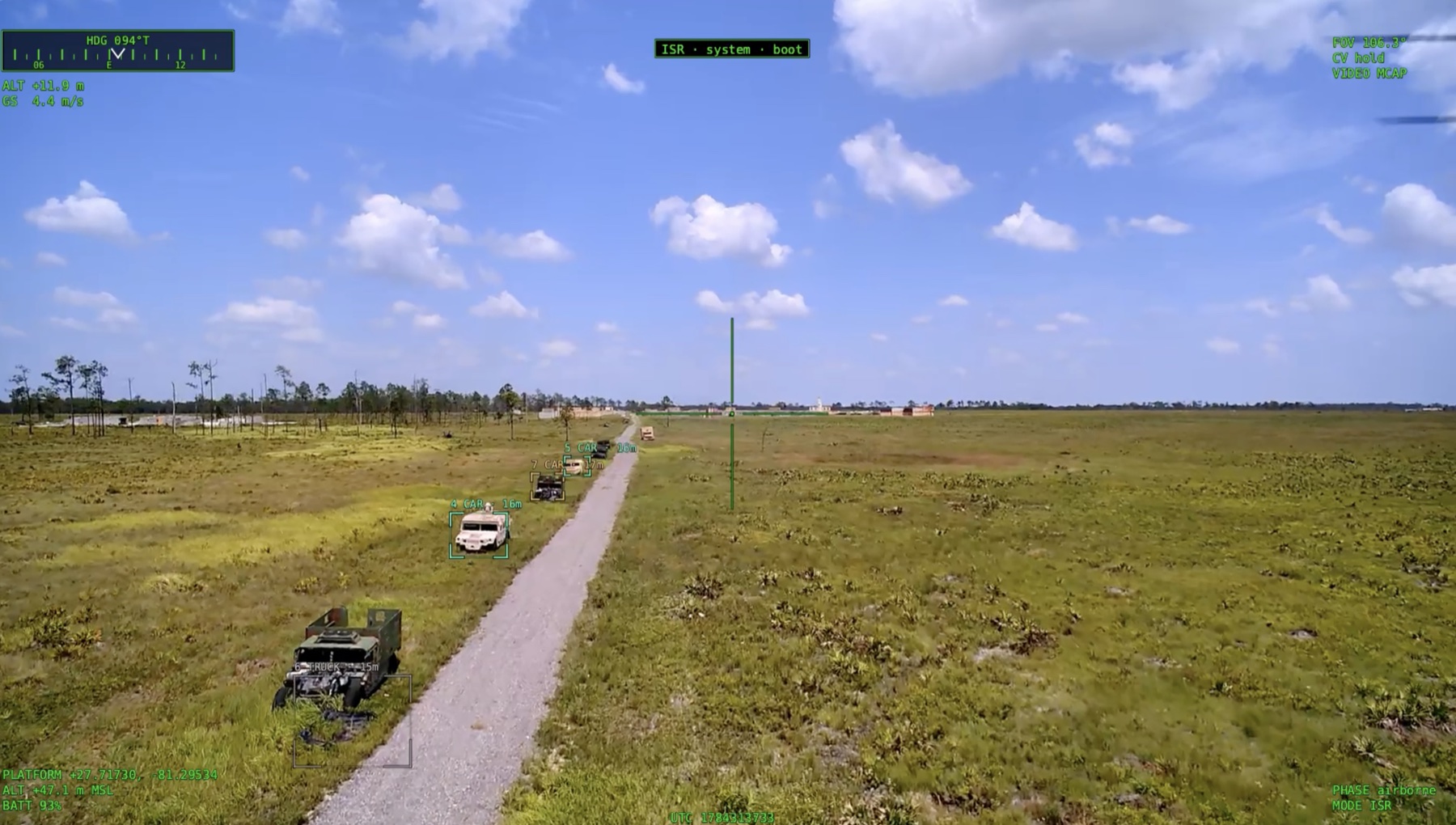
On-device models turn video, RF, acoustic, LiDAR, and telemetry into concise, confidence-aware events before transmission—preserving scarce bandwidth and keeping the operator focused on decisions.
A sovereign neural runtime, modular hardware, collaborative mission services, and one assumption: the mission must continue when any single network path does not.
Controlled scene and asset generation expands mission-approved training sets across viewpoint, lighting, weather, clutter, and occlusion—then feeds those cases into the same evaluation workflow as field evidence.
Program-reviewed synthetic examples can supplement scarce task data for narrow command-routing, planning, and tool-use models without exposing sensitive source material to a public service.
Review evidence, analyze failure modes, build a candidate, evaluate it against mission thresholds, and promote only an approved artifact. Arc-Forge keeps the improvement loop close and accountable.
Small language models tuned for narrow mission tasks interpret objectives, constraints, and tool schemas locally—supporting planning, operator interaction, and policy-bounded action.
Arc separates the mission from the bearer. Program-selected radios, mesh, LTE/5G, and SATCOM can be integrated as primary, alternate, contingency, and emergency paths for the target platform.
Vehicles and sensor nodes can share bounded tasking, mission state, tracks, and conclusions across the configured network. Swarm behavior is integrated and qualified for each program and safety envelope.
A modular carrier architecture keeps compute, acceleration, sensor, vehicle-bus, and radio upgrades from forcing a complete platform redesign.
EO/IR, LiDAR, RF, acoustic, telemetry, and TAK observations can be normalized into a confidence-aware local world model with source provenance preserved.
On-device agents can use approved tools to query mission state, propose or issue bounded tasking, publish CoT events, and chain controlled workflows at the edge.
Local model, data, and inference workflows support disconnected deployments. External access, release controls, and approval boundaries are configured with the program.
Perception, reasoning, voice, fusion, and mission actions run on the platform or local mission network. DDIL is the design assumption; connectivity expands the mission without owning it.
Arc builds on open-source foundations, including LlamaFarm and Atmosphere. Programs can deploy core workflows inside customer-controlled infrastructure, define data boundaries, and negotiate model, sensor-data, and mission-log rights in the acquisition terms. Open interfaces preserve an exit path without promising that every mission dependency is open source.
Powered by Rownd
